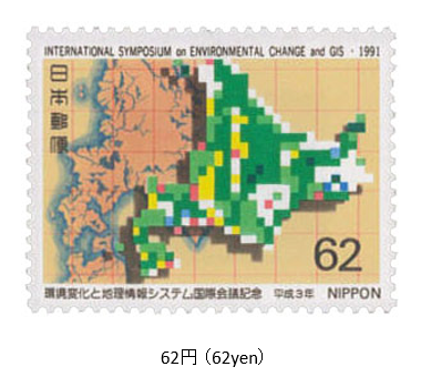
環境変化と地理情報システム会議 1991年(平成3年)8月23日 発行 1991年8月、北海道で「環境変化と地理情報システム世界会議」が開催された。地理情報システム(GIS)は人工衛星や地上の実測による地理データを分析管理し、生活必要情報として活用することである。この会議には、GISの地理学者と技術者に加え、環境学者が、人間活動と環境との関連性、環境変化のメカニズムや影響を研究発表や情報交換を行った。切手は、この会議を記念して発行され、「デジタル化された北海道地図」がデザインされている。
Int. Symposium on Environmental Change and GIS.
Issued on August 23, 1991 (Heisei 3)
In August 1991, the "World Conference on Environmental Change and Geographic Information Systems" was held in Hokkaido. Geographic information system (GIS) analyzes and manages geographic data measured by artificial satellites and ground, and utilizes it as necessary information for daily life. At this conference, GIS geographers and engineers, as well as environmental scientists, presented research and exchanged information on the relationship between human activities and the environment, and the mechanisms and effects of environmental changes.
The stamp was issued in commemoration of this conference, and a "digitized map of Hokkaido" was designed.
