下北半島国定公園 1969 (昭和44年) 7 月 15 日発行
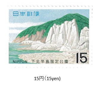
1969年 (昭和44) 7月、郵政省は下北半島国定公園切手1種を発行した。
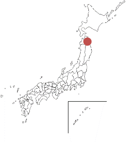
下北半島国定公園は、青森県下北半島がエリアである。1968年に指定され、公園面積は187㎢である。半島北東部の尻屋(しりや)崎、本州最北端の大間(おおま)崎、半島西岸佐井から牛の首岬へ至る海岸線、半島中央部の恐山 (おそれざん)の4地区からなる。尻屋崎は、石灰岩の海食台地で、岩塊が重なり豪壮な景観をみせる。
切手は、仏ヶ浦がデザインされている。
Shimokita Hantō Quasi-National Park Issued on 7 , 15 , 1969 (Showa 44)
In July 1969 (Showa 44), the Ministry of Posts and Telecommunications issued one type of Shimokita Peninsula Quasi-National Park stamp.
The Shimokita Peninsula Quasi-National Monument is located in the Shimokita Peninsula, Aomori Prefecture.
Designated in 1968, the park area is 187 ㎢. It consists of four districts: Shiriyazaki in the northeastern part of the peninsula, Omazaki in the northernmost part of Honshu, the coastline from Sai on the west coast of the peninsula to Cape Ushikubi, and Osorezan in the central part of the peninsula.Shiriyazaki is a limestone seafood. plateau, and the rock masses overlap to give a magnificent view.
The stamp is designed by Hotokegaura.

