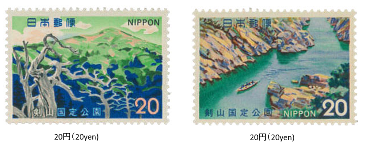
剣山国定公園 1973 (昭和48) 2 月 20 日発行
1973年 (昭和48) 2月、郵政省は剣山国定公園切手2種を発行した。
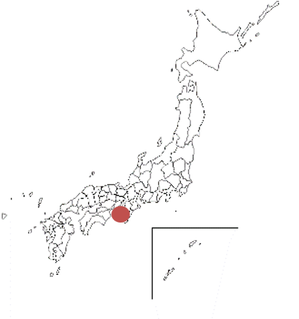
剣山国定公園は徳島と高知県にわたる四国の剣山地を中心としている。吉野川流域の大歩危 (おおぼけ)・小歩危(こぼけ)、祖谷(いや)をそのエリアとする。1964年に指定され、公園面積は約210㎢である。剣山地は、石鎚(いしづち)山に次ぐ四国第二の高峰剣山 (1955m) を主峰とし、高城(たかしろ)山、天神丸、塔丸(とうまる)、石立(いしだて)山などの山々が連なる。
切手は、「剣山」と「大歩危」がデザインされている。
Tsurugi San Quasi-National Park Issued on 2 , 20 , 1973 (Showa 48)
In February 1973 (Showa 48), the Ministry of Posts and Telecommunications issued two types of stamps for Tsurugisan Quasi-National Park.
Tsurugisan Quasi-National Park is centered on the Tsurugisanchi area of Shikoku, which spans Tokushima and Kochi prefectures. The areas are Oboke, Koboke, and Iya in the Yoshino River basin.Designated in 1964, the park area is about 210㎢. The main peak of Tsurugisanchi is Mt. Ishizuchi, the second highest peak in Shikoku (1955m).
Mountains such as Mt. Takashiro, Mt.Tenjin, Mt. Tomaru, and Ishidate are connected. The stamps are designed with "Mt. Tsurugisan" and "Oboke".